
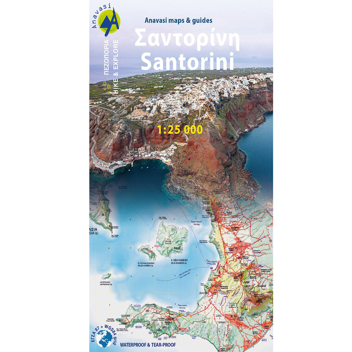
Santorini – Hiking map 1:25 000

€ 8.50 incl. VAT
Currency conversions are provided for informational purposes only. Checkout is done in EURO.
25 hiking trails on Santorini and Thirasia
1:25000 | GPS compatible
Waterproof, rip-proof plastic map
Published by Anavasi (2022)
ISBN:978-960-9412-72-8
9 in stock
Estimated shipping date: 09 Mar 2026
Hiking map of Santorini island in a scale of 1:25 000
As you enter the caldera of Santorini by ferry sheer cliffs rise up dramatically, exposing richly coloured rock strata, crowned by the colored houses of the cliff-top settlements. Equally magnificent is the sunset from the heights of the caldera towards the sea and the remnants of prehistoric rounded island Strogyli, Thirasia, the New and Old Kameni. However, there is more than the visual excitement to discover and if you don’t take the time to walk the island you will have learnt little of Santorini.
The new Anavasi map will take hiking in every corner, beach and hill top of Santorini and Thirassia to discover landscapes with visible signs of the traditional rural culture, with orchards stonewalls, threshing floors, huts, chapels, inland villages with a well preserved medieval core (called Castelo), routes with wonderful vistas, lost beaches quiet even in the heart of summer.
On the reverse side of the map, there is a brief description of the 25 proposed hiking routes and a short guide of the two islands, Santorini and Thirassia
Only logged in customers who have purchased this product may leave a review.
Related Products


Reviews
There are no reviews yet.